
NASA’s Global Ecosystem Dynamics Investigation mission (GEDI) released its first publicly available data on January 21, 2020, giving researchers access to measurements of forests around the world.
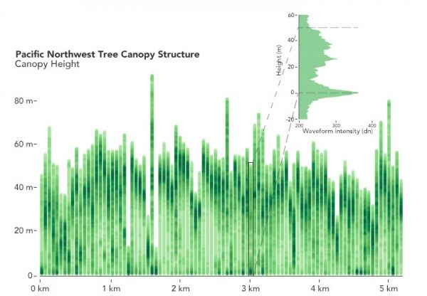
GEDI (pronounced like the Jedi of “Star Wars” fame) surveys Earth’s forests from aboard the International Space Station, using its three lasers to construct detailed 3-dimensional (3D) maps of forest canopy height and the distribution of branches and leaves in the forest. By accurately measuring forests in 3D, GEDI data play an important role in understanding how much biomass and carbon forests store and how much they lose when disturbed — vital information for understanding Earth’s carbon cycle and how it is changing. Data from the mission can also be used to study plant and animal habitats and biodiversity, and how these may change over time.
The first data release contains the first eight weeks of GEDI data: Hundreds of millions of data points, covering the globe between southern Canada and the tip of South America. By the time it reaches its 2nd birthday, GEDI will have collected an estimated 10 billion laser observations, representing the most comprehensive global satellite data set on forest structure ever produced.
“Existing pan-tropical biomass maps use laser data acquired nearly 15 years ago and were based on less than 5 million laser observations in total,” said Ralph Dubayah, GEDI principal investigator and a professor of geographical sciences at the University of Maryland. “GEDI collects 6 million laser observations every day. So over the tropics, we’ve already collected about two orders of magnitude more data than what was ‘state-of-the-art’ before.”
Continue reading at NASA Goddard Space Flight Center
Image via NASA Goddard Space Flight Center


