
Tropical Cyclone 12P formed in the Southern Pacific Ocean on January 25 and two days later, NASA’s Aqua satellite observed the storm’s demise.
Tropical Cyclone 12P formed in the Southern Pacific Ocean on January 25 and two days later, NASA’s Aqua satellite observed the storm’s demise.
Tropical Cyclone 12P formed on January 25 at 10 a.m. EST (1500 UTC) about 142 nautical miles southeast of Niue. That was the peak for 12P, as maximum sustained winds reached 35 knots (40 mph).
On January 26, the Joint Typhoon Warning Center issued their final warning on Tropical cyclone 12P at 10 a.m. EST (1500 UTC). At that time, 12P had weakened to a depression with maximum sustained winds near 25 knots. It was located near latitude 22.4 degrees south and longitude 166.4 degrees west, about 279 miles southeast of Niue. The depression was moving southeast and weakening to a remnant low pressure area.
Read more at NASA / Goddard Space Flight Center
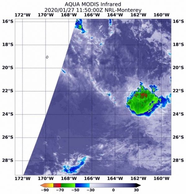
Image: On January 27 at 6:50 a.m. EST (1150 UTC), the MODIS instrument aboard NASA’s Aqua satellite gathered temperature information about Tropical Depression 12P’s cloud tops. MODIS found one small area of powerful thunderstorms (red) where temperatures were as cold as or colder than minus 70 degrees Fahrenheit (minus 56.6 Celsius). The storm was dissipating. Credit: NASA/NRL


