
Shortly after Tropical Cyclone Francisco formed on Feb. 5 in the Southern Indian Ocean, NASA’s Aqua satellite provided a visible image of the storm.
Shortly after Tropical Cyclone Francisco formed on Feb. 5 in the Southern Indian Ocean, NASA’s Aqua satellite provided a visible image of the storm.
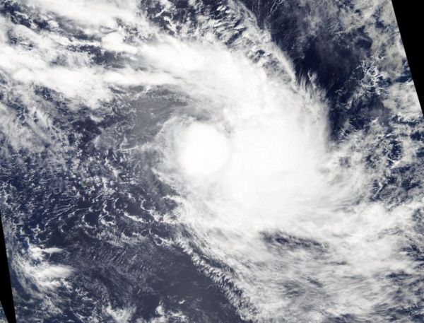
On Feb. 5, 2020, the Moderate Resolution Imaging Spectroradiometer or MODIS instrument that flies aboard NASA’s Aqua satellite provided a visible image of Francisco that showed powerful thunderstorms around the low-level center. Satellite imagery showed shallow thunderstorm banding wrapping into the center of the low-level center and strong convective bands of thunderstorms over the eastern semicircle.
On Feb. 5 at 4 a.m. EST (0900 UTC), the Joint Typhoon Warning Center (JTWC) noted that Tropical Cyclone Francisco was located near latitude 17.3 degrees south and longitude 68.5 degrees east, about 647 nautical miles east-southeast of Mauritius. Maximum sustained winds 40 knots (46 mph/74 kph). This storm is moving to the southeastward.
Read more at NASA / Goddard Space Flight Center
Image: On Feb. 5, 2020, the MODIS instrument that flies aboard NASA’s Aqua satellite provided a visible image of Tropical Storm Francisco after it formed in the Southern Indian Ocean. Credit: NASA Worldview


