
Forecasters use a variety of satellite imagery to understand what is happening in a storm, and sometimes just a visible picture can tell a lot.
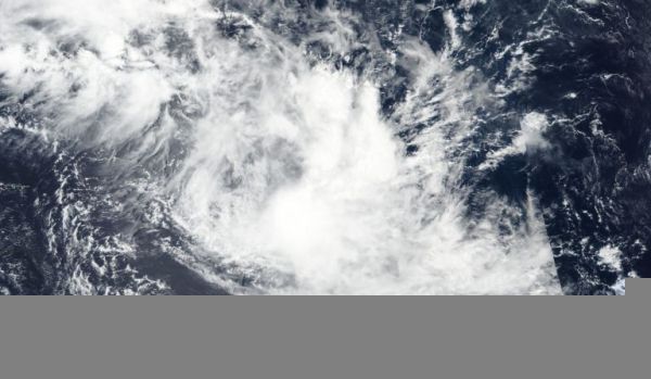
Forecasters use a variety of satellite imagery to understand what is happening in a storm, and sometimes just a visible picture can tell a lot. NASA-NOAA’s Suomi NPP satellite provided forecasters with a visible image of the Tropical Storm Francisco in the Southern Indian Ocean that showed wind shear was pushing clouds away from the storm’s center.
Visible imagery from satellites helps forecasters understand if a storm is organizing or weakening, or if it is being affected by vertical wind shear. The shape of a tropical cyclone provides forecasters with an idea of its organization and strength. When outside winds, that is, vertical wind shear, batter a storm it can change the shape of it and push much of the associated clouds and rains to one side of it.
In general, wind shear is a measure of how the speed and direction of winds change with altitude. Tropical cyclones are like rotating cylinders of winds. Each level needs to be stacked on top each other vertically in order for the storm to maintain strength or intensify. Wind shear occurs when winds at different levels of the atmosphere push against the rotating cylinder of winds, weakening the rotation by pushing it apart at different levels.
Read more at NASA / Goddard Space Flight Center
Image: NASA-NOAA’s Suomi NPP satellite passed over Tropical Storm Francisco on Feb. 6, 2020 and revealed wind shear was pushing the bulk of its clouds to the southeast of its center. Credit: NASA Worldview, Earth Observing System Data and Information System (EOSDIS)


