
Winds outside of Tropical Storm Gabekile are ripping the storm apart.
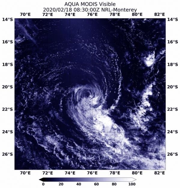
Winds outside of Tropical Storm Gabekile are ripping the storm apart. NASA’s Aqua satellite provided a visible image of the storm that showed strong northwesterly wind shear was adversely affecting the storm.
Gabekile formed on Feb. 15 and by the next day, it had rapidly intensified to hurricane-force with maximum sustained winds near 75 knots (86 mph/139 kph), then after encountering wind shear the storm quickly weakened.
In general, wind shear is a measure of how the speed and direction of winds change with altitude. Tropical cyclones are like rotating cylinders of winds. Each level needs to be stacked on top each other vertically in order for the storm to maintain strength or intensify. Wind shear occurs when winds at different levels of the atmosphere push against the rotating cylinder of winds, weakening the rotation by pushing it apart at different levels.
Read more at NASA / Goddard Space Flight Center
Image: On Feb. 18, 2020, the MODIS instrument that flies aboard NASA’s Aqua satellite provided a visible image of the dissipating Tropical Cyclone Gabekile in the Southern Indian Ocean. Credit: NASA NRL


