
Hot air rises, cold air sinks. It’s a basic tenet of nature.
Hot air rises, cold air sinks. It’s a basic tenet of nature.
Because it sinks, cold air often finds depressions or low-lying terrain, like a valley or basin, in which to collect, particularly at night as temperatures decrease. As the sun rises and temperatures rise, the cold air warms and mixes with the surrounding air. But during winter, and even into spring, this cold air can linger — often for several days — in a phenomenon known as a “cold pool event.”
Cold pools can trap pollutants that would normally mix and disperse with larger air currents, causing serious health risks in heavily populated urban areas. Known to reduce wind speeds and produce freezing rain, they also can negatively impact wind turbines in the area, diminishing electricity production in the short term and potentially damaging turbines.
Researchers at the U.S. Department of Energy’s (DOE) Argonne National Laboratory recently collaborated in an 18-month, multi-institutional field campaign with the National Oceanic and Atmospheric Administration and other DOE-sponsored laboratories to study cold pool events in the Columbia River Gorge, along the Oregon-Washington border. The goal of the research is to better understand and forecast cold pool events, as part of DOE’s Wind Forecast Improvement Project. Their findings were recently published in the Journal of Applied Meteorology and Climatology.
Read more at DOE/Argonne National Laboratory
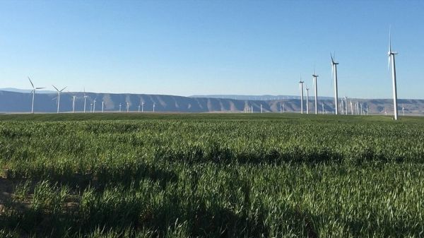
Image: Wind turbines along the Columbia River Gorge. (Credit: Paytsar Muradyan / Argonne National Laboratory)


