
NASA’s Aqua satellite continues to provide forecasters with a visible image ex-tropical cyclone Esther’s remnant clouds and storms, now over the Barkly Region of Australia’s Northern Territory.
NASA’s Aqua satellite continues to provide forecasters with a visible image ex-tropical cyclone Esther’s remnant clouds and storms, now over the Barkly Region of Australia’s Northern Territory.
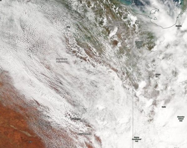
On March 4, the Moderate Resolution Imaging Spectroradiometer or MODIS instrument that flies aboard NASA’s Aqua satellite provided a visible image of Esther’s remnant clouds that showed the center over the Barkly region of the Northern Territory.
The Barkly Region is located in the west central part of the territory and the region’s main town is Tennant Creek. The region covers an area of 124,600 square miles (322,713 square km). Esther’s clouds stretched into Queensland.
On March 4, the Australian Bureau of Meteorology (ABM) issued a Flood Watch for the Tanami Desert, Central Desert, MacDonnell Ranges, Barkly, Georgina River and Simpson Desert.
Read more at NASA / Goddard Space Flight Center
Image: On Mar. 4, 2020, the MODIS instrument that flies aboard NASA’s Aqua satellite provided a visible image of Esther’s remnant clouds centered over the Barkly area of the Northern Territory. Credit: NASA Worldview


