
Ninety years ago there were no satellites to detect changes in Greenland’s coastal glaciers, but a new study combining historical photos with evidence from ocean sediments suggests climate change was already at work in the 1930s and led to a major collapse of the one of Greenland’s largest coastal glaciers.
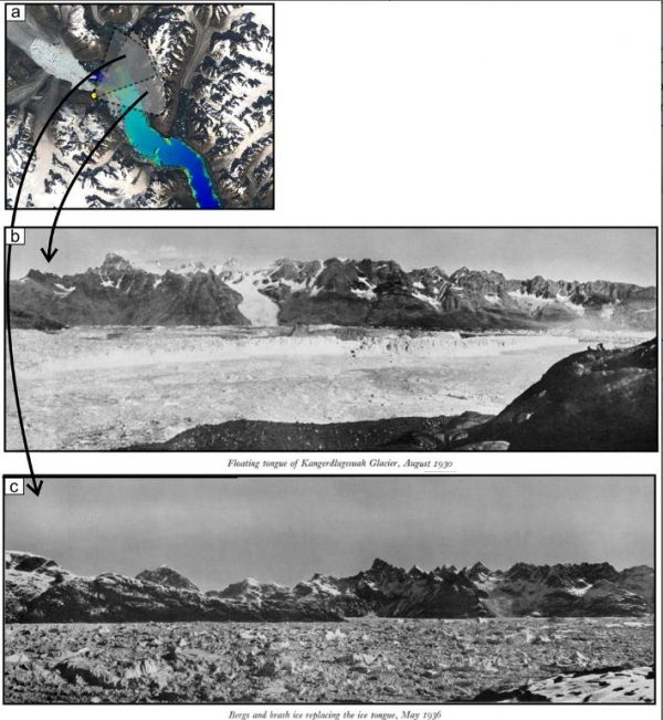
The only reason scientists today know about the Kangerlussuaq Glacier’s dramatic retreat in the 1930s is the existence of both aerial and ground-level photos taken by explorers before and after the glacier’s tongue had dislodged itself from a submarine ridge. The ridge had pinned the glacier in place, perhaps making the glacier relatively more stable than many other coastal Greenland glaciers.
“We found out about the collapse by looking at old pictures,” said geologist Flor Vermassen of the Geological Survey of Denmark and Greenland. “And this matched our findings from the sediments.” Vermassen is the lead author of a new paper describing the Kangerlussuaq collapse in the AGU journal Geophysical Research Letters.
The historical aerial and ground-level photos were from Danish and British expeditions that set out to Greenland’s east coast from 1930 through 1935. The photos show a dramatic retreat of the glacier following a well-documented period of air and water warming in the 1920s, Vermassen explained.
Continue reading at American Geophysical Union
Image via American Geophysical Union


