
NASA-NOAA’s Suomi NPP satellite passed over the Southern Indian Ocean and provided forecasters with a visible image of newly formed Tropical Storm 21S.
NASA-NOAA’s Suomi NPP satellite passed over the Southern Indian Ocean and provided forecasters with a visible image of newly formed Tropical Storm 21S.
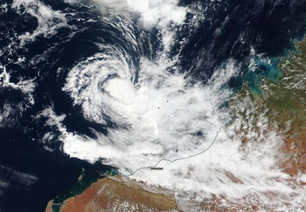
The Visible Infrared Imaging Radiometer Suite (VIIRS) instrument aboard Suomi NPP provided a visible image of Tropical Cyclone 21S that revealed strong thunderstorms circling the center of circulation. Strong storms were also in the southeastern quadrant of the storm which extended to the coast of Western Australia.
At 0900 UTC, (5 a.m. EDT) Tropical Cyclone 21S was located near latitude 16.4 degrees south and longitude 116.9 degrees east, about 253 nautical miles north-northwest of Port Hedland, Australia. 21S was moving to the south and had maximum sustained winds near 35 knots (40 mph/65 kph). The storm is not expected to strengthen much before it makes landfall in Western Australia.
Read more at NASA/Goddard Space Flight Center
Image: NASA-NOAA's Suomi NPP satellite passed over the Southern Indian Ocean and captured a visible image of newly formed Tropical Storm 21S off the coast of Western Australia. (Credit: NASA Worldview, Earth Observing System Data and Information System (EOSDIS))


