
NASA’s Terra satellite passed over the Southern Indian Ocean and provided forecasters with a visible image of newly formed Tropical Storm 22S, located near northeastern Madagascar.
NASA’s Terra satellite passed over the Southern Indian Ocean and provided forecasters with a visible image of newly formed Tropical Storm 22S, located near northeastern Madagascar.
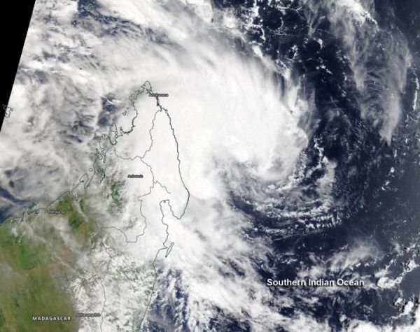
The Moderate Resolution Imaging Spectroradiometer or MODIS instrument aboard Terra provided a visible image of Tropical Cyclone 22S that revealed strong thunderstorms had circled the center of circulation and western quadrant. A banding of thunderstorms on the western side were bringing rainfall and gusty winds to northeastern Madagascar. Satellite imagery also shows the storm consolidating.
At 0900 UTC, (5 a.m. EDT) Tropical Cyclone 22S was located near latitude 14.3 degrees south and longitude 52.4 degrees east, about 447 nautical miles north-northwest of Port Louis, Mauritius. 22S was moving to the west-southwest and had maximum sustained winds near 35 knots (40 mph/65 kph).
Read more at NASA/Goddard Space Flight Center
Image: NASA's Terra satellite captured the formation of Tropical Storm 22S near northeastern Madagascar on March 13, 2020. (Credit: NASA Worldview, Earth Observing System Data and Information System (EOSDIS))


