
Wind shear pushed former Tropical Cyclone Herold apart and infrared imagery from NASA’s Aqua satellite showed the system with very little strength remaining.
Wind shear pushed former Tropical Cyclone Herold apart and infrared imagery from NASA’s Aqua satellite showed the system with very little strength remaining.
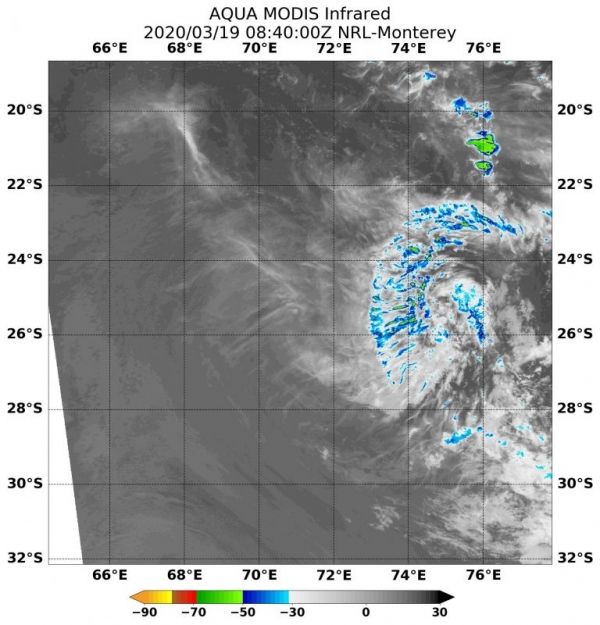
NASA’s Aqua satellite uses infrared light to analyze the strength of storms by providing temperature information about the system’s clouds. The strongest thunderstorms that reach high into the atmosphere have the coldest cloud top temperatures.
On March 19, 2020, the Moderate Resolution Imaging Spectroradiometer or MODIS instrument that flies aboard NASA’s Aqua satellite gathered infrared data on Herold. Animated multispectral satellite imagery showed Herold’s low-level circulation center is partially exposed and there is minimal associated strong convection (rising air that forms the thunderstorms that make up tropical cyclones). Strongest thunderstorms had cloud top temperatures as cold as minus 50 degrees Fahrenheit (minus 45.5 Celsius).
Read more at NASA / Goddard Space Flight Center
Image: On March 19, 2020, the MODIS instrument that flies aboard NASA’s Aqua satellite gathered infrared data on Herold. MODIS showed minimal associated strong convection (rising air that forms the thunderstorms that make up tropical cyclones). Strongest thunderstorms had cloud top temperatures (blue) as cold as minus 50 degrees Fahrenheit (minus 45.5 Celsius). Credit: NASA/NRL


