
When it erupted in January 2020, Taal Volcano blanketed the surrounding area with volcanic debris that has taken a toll on farmers.
On January 12, 2020, the Taal Volcano in the Philippines awoke from 43 years of quiet and began to spew gases, ash, and lava into the air. In the days and weeks that followed, the eruption dropped a layer of unusually wet, heavy ash on the surrounding landscape, withering vegetation and turning the lush fields and forests of Volcano Island a ghostly gray.
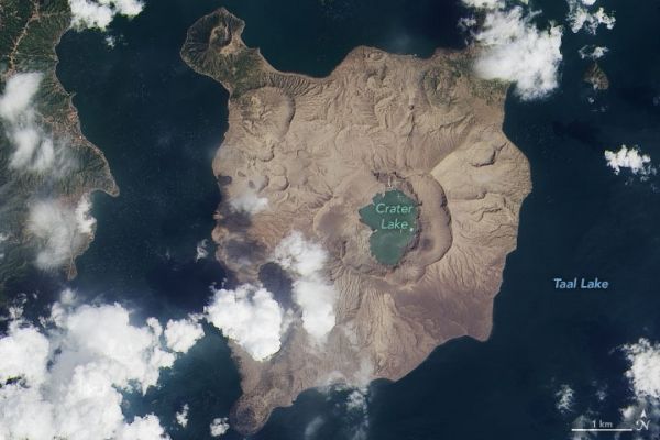
Two months later, the ash-damaged landscape still looks more like the Moon than the tropics. On March 11, 2020, the Operational Land Imager (OLI) on Landsat 8 acquired an image of Taal that underscores the consequences of the ashfall. For comparison, the other image shows the same area on December 6, 2019.
Aside from a few green promontories on the north side of the island, ash has altered much of the landscape, including several villages along the coasts. “Most of the ash has likely washed away by now, but signs of it will persist for millennia in the rock record,” explained Erik Klemetti, a volcanologist at Denison University. “Most of the ash that fell within the caldera is in the process of getting concentrated into gullies and streams or deposited into the lake.”
Continue reading at NASA Earth Observatory
Image via NASA Earth Observatory


