
Former Tropical Cyclone Herold is now a fading area of low-pressure in the Southern Indian Ocean and NASA’s Aqua satellite provided forecasters with a visible image.
Former Tropical Cyclone Herold is now a fading area of low-pressure in the Southern Indian Ocean and NASA’s Aqua satellite provided forecasters with a visible image.
On Mar. 19 at 4 p.m. EDT (2100 UTC), the Joint Typhoon Warning Center issued their final bulletin on Herold. At that time, Herold’s center was located near latitude 26.6 degrees south and longitude 73.0 degrees east, approximately 948 nautical miles east-southeast of Port Louis, Mauritius. Herold’s maximum sustained winds at the time were near 30 knots (34.5 mph/55.5 kph) making it a tropical depression. It has since weakened.
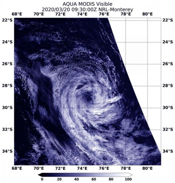
On Mar. 20, the Moderate Resolution Imaging Spectroradiometer or MODIS instrument that flies aboard NASA’s Aqua satellite provided a visible image of the clouds circling Herold’s center. The clouds appeared wispy and devoid of heavy rainfall. The storm showed no strong convection (rising air that forms the thunderstorms that make up a tropical cyclone). Herold has moved over cooler waters which have sapped thunderstorm development.
Read more at NASA/Goddard Space Flight Center
Image: On Mar. 20, 2020, the MODIS instrument that flies aboard NASA's Aqua satellite provided a visible image ex-tropical cyclone Herold in the Southern Indian Ocean. (Credit: NASA Worldview)


