
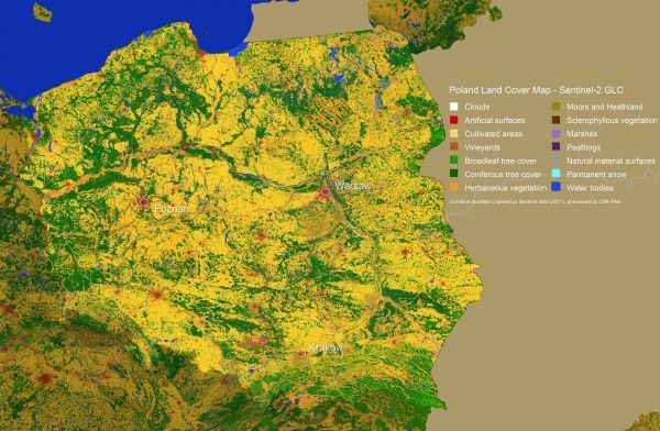
Earth’s land is covered by a range of different types of vegetation, from forest and marsh to crops and bodies of water, as well as the artificial surfaces that are an increasingly common feature of our landscape.
Mapping land cover is not only essential for monitoring change, but it also underpins numerous practical applications. However, generating these maps entails handling huge amounts of satellite data and some technical expertise. Thanks to the Copernicus Sentinel-2 mission and new cloud-computing resources, fully automated land-cover maps in 10 m resolution are on the horizon.
Natural processes, climate change and the way we use land to feed, shelter and support a growing population means that Earth’s land cover is in a continual state of change.
Information on land cover is important at many levels – at local, regional, national and global scales, and over different timescales.
Up-to-date maps are a basic source of information to track the impact that human activity, natural processes and climate change have on land cover. These maps are critical for making informed policy, development and resource management decisions, and for disciplines such as agriculture, forestry, water management, urban planning, environmental protection and crisis management.
Continue reading at European Space Agency
Image via European Space Agency


