
Researchers are using satellite data to understand where locusts may spread during the largest infestation in eastern Africa in decades.
A single desert locust (Schistocerca gregaria) can consume its body weight in vegetation in one day. That may not sound like much for one 2.5-gram locust, but when 40 million of them gather—considered a small swarm—they can devour as much food as 35,000 people. In one day, a small swarm can jeopardize a farmer’s livelihood.
Since December 2019, croplands in Kenya have been inundated by the voracious insects. By January 2020, at least 70,000 hectares (173,000 acres) of land were infested—Kenya’s worst locust event in 70 years. In February, the swarms spread to ten countries in eastern Africa, threatening food supplies for millions of people. Ethiopia and Somalia have seen their worst locust infestations in 25 years. The United Nations (UN) has warned that the upcoming rainy season may make things worse.
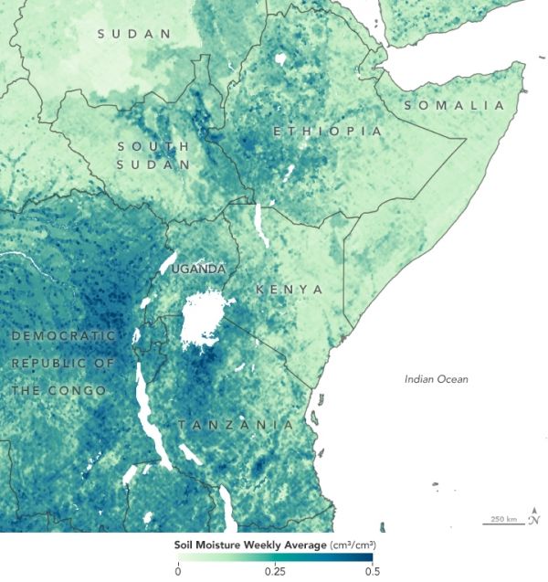
NASA-funded scientists are partnering with the UN and relief organizations to better understand where locusts are likely to swarm. Using remote sensing observations of soil moisture and vegetation, researchers are tracking how environmental conditions influence locust life cycles and hoping to stop outbreaks before they spread.
Continue reading at NASA Earth Observatory
Image via NASA Earth Observatory


