
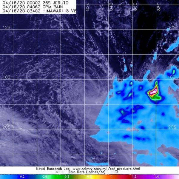
NASA analyzed weakening Tropical Storm Jeruto’s rainfall and found one small area of moderate rainfall displaced from the center, because of strong wind shear.
NASA analyzed weakening Tropical Storm Jeruto’s rainfall and found one small area of moderate rainfall displaced from the center, because of strong wind shear.
In general, wind shear is a measure of how the speed and direction of winds change with altitude. Outside winds were pushing against the storm and displacing the heaviest rainfall east of the center.
On April 15 at 5 p.m. EDT (2100 UTC), The Joint Typhoon Warning Center noted that Tropical Storm Jeruto was barely holding onto tropical storm status with maximum sustained winds near 35 knots (40 mph/65 kph). Jeruto was located near latitude 16.2 degrees south and longitude 83.1 degrees east, about 828 nautical miles southeast of Diego Garcia.
Read more at NASA/Goddard Space Flight Center
Image: The GPM core satellite passed over Tropical Storm Jeruto on April 16 at 12:06 a.m. EDT (0406 UTC). Winds pushed the heaviest rainfall (pink) east of the center, where it was falling at a rate of 1.6 inches (40 mm) per hour in a small area. (Credit: NASA/JAXA/NRL)


