
One of the more intense tornados to raze the ground in April 2020 left a scar visible from space.
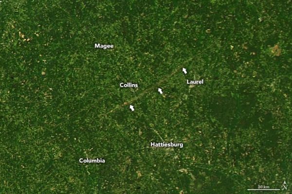
Severe storms with high winds ripped through much of the southern and eastern United States in mid-April, with tornado warnings stretching from Florida to Virginia. More than a dozen tornadoes were confirmed in Mississippi, including one on April 12, 2020, that scarred the landscape to such a degree that it could be seen from space.
The scar is visible in a natural-color image (top), acquired on April 14, 2020, with the Moderate Resolution Imaging Spectroradiometer (MODIS) on NASA’s Aqua satellite. It shows where the tornado uprooted vegetation and spread debris along a path nearly 70 miles long from Jefferson Davis County to Clarke County in the southeast part of the state. Preliminary reports from the National Weather Service indicate that the storm was an EF4—the second-highest intensity on the Enhanced Fujita scale.
The signature of the scar is also apparent in the second image, which shows land surface temperature data also acquired by Aqua MODIS.
Continue reading at NASA Earth Observatory
Image via NASA Earth Observatory


