
A new web tool designed by NASA applied scientists could help the tribe anticipate and respond to drought.
Carlee McClellan has a mission: monitor water supplies and assess drought conditions for the Navajo Nation. Amber McCullum has a mission: make NASA satellite data more useful to resource managers and local communities, particularly underserved communities. Together, McCullum and McClellan are building a web-based tool that does both of those things.
Tucked into the Four Corners region of the U.S. Southwest, the Navajo Nation spans 27,000 square miles (71,000 square kilometers). It is some of the driest territory in North America, with a diverse geography ranging from low-lying desert to the San Juan River valley to the Chuska Mountains. Of the nearly 200,000 Navajo people spread across that land, about 30 percent do not have access to reliable, clean drinking water and roughly 40 percent lack running water in their homes. Some people haul water more than 50 miles to replenish their cisterns.
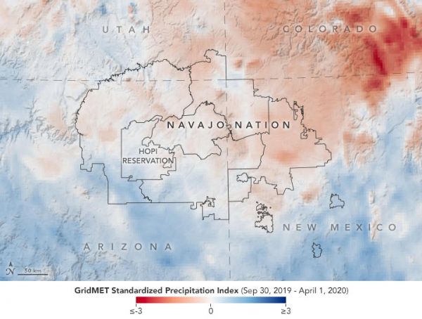
Drought is frequent and pervasive here. It is a nation in need of reliable and detailed information about water resources, whether that water falls from the sky, runs down from snow-capped mountains, or gets pumped up from wells. According to a report from the U.S. Drought Monitor on April 14, 2020, moderate to severe drought conditions were affecting much of the area.
Continue reading at NASA Earth Observatory
Image via NASA Earth Observatory


