
Geography and a prolonged period of wet weather have made flooding common on this river in the Northern Plains.
The flood-prone Red River has overtopped its banks once again. An unusually wet fall and winter, combined with spring melting and the river’s unique geography, drove the water levels up in April 2020.
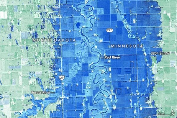
On April 17, 2020, the Operational Land Imager (OLI) on Landsat 8 acquired this image of flooded farmland along the river in Marshall County, Minnesota, and Walsh County, North Dakota. At the time, a stream gauge at Drayton, North Dakota, recorded water levels of 43 feet (13 meters), just high enough to be classified as major flooding. The second image shows the same area in May 2015, when water levels were lower.
The map below highlights flooded areas using the normalized difference water index (NDWI), a tool combining observations of infrared and visible light to make it easier to distinguish between water and land.
Continue reading at NASA Earth Observatory
Image via NASA Earth Observatory


