
Powerful thunderstorms moving through eastern Texas and western Louisiana spawned several tornadoes, including some that caused major damage.
On April 22-23, 2020, powerful thunderstorms blew across eastern Texas and western Louisiana and spawned several tornadoes, including some that caused severe damage.
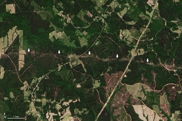
The Operational Land Imager (OLI) on Landsat 8 acquired this image showing the trail of damage caused by an EF-2 tornado that tore through Jasper and Newton counties in Texas. According to the National Weather Service, the storm had peak winds of 130 miles (210 kilometers) per hour. It damaged roofs and snapped trees along a track that extended 37 miles (60 kilometers). While this tornado passed through a rural area and caused no injuries, the same supercell storm system spawned several other tornadoes, some of which caused injuries, deaths, and severe damage to homes in several places in the region.
Scientists with NASA’s Earth applied sciences disasters program work regularly with National Weather Service offices to locate satellite images that can aid in damage assessments after tornadoes touch down.
Continue reading at NASA Earth Observatory
Image via NASA Earth Observatory


