
April 2020 has become a month of note for severe weather in the Southeastern United States.
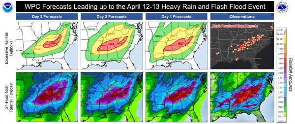
Starting around April 6, guidance trends began to suggest an active period of severe weather for the region. National Weather Service forecasters across the Southeastern U.S., as well as at the Storm Prediction Center (SPC) in Norman, Oklahoma, and the Weather Prediction Center (WPC) in College Park, Maryland, began poring over data and creating their outlooks and forecasts with growing concern. The data were hinting at a disturbing trend for a major severe weather outbreak, including tornadoes and flash flooding, across the southern states for April 11-12.
Then, as they were cleaning up from one major outbreak, a second outbreak of flooding rains and severe weather began to look likely in the same locations, just a week later. Forecasters in these offices have been in high gear for most of April, collaborating numerous times to share insight and expertise about the evolving forecast in order to provide accurate and consistent information to our partners and the public. After this second round of severe weather rolled through, it happened again.
Four days later, another outbreak of tornadoes and flash flooding moved across virtually the same geographic area, putting forecasters on the front lines again, preparing our partners and public, and continuing to alert the public of the threat until the last warnings were cancelled.
Continue reading at National Weather Service
Image via National Weather Service


