
A low-pressure area that formed in the Northwestern Pacific Ocean several days ago has consolidated and organized into a tropical storm.
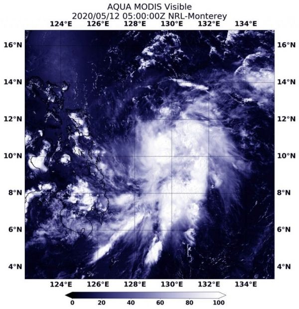
NASA’s Aqua satellite provided forecasters with a visible image of newly formed Tropical Storm Vongfong.
Vongfong, known locally as Ambo in the Philippines, threatens that country, according to the forecasts from the Joint Typhoon Warning Center or JTWC. The storm is also the first of tropical cyclone of the Northwestern Pacific Ocean typhoon season.
On May 12, the Moderate Resolution Imaging Spectroradiometer or MODIS instrument that flies aboard NASA’s Aqua satellite provided a visible image of Vongfong that showed the storm had a more rounded shape than it did the previous day, as it continued to consolidate. A more rounded shape in a tropical cyclone indicates it is becoming a more organized storm. Infrared satellite imagery also indicated cooling cloud top temperatures, which means that cloud tops are extending higher into the troposphere. The higher the cloud top, the stronger the uplift of air in a storm, and usually, the stronger the storm.
Continue reading at NASA Goddard Space Flight Center
Image via NASA Goddard Space Flight Center


