
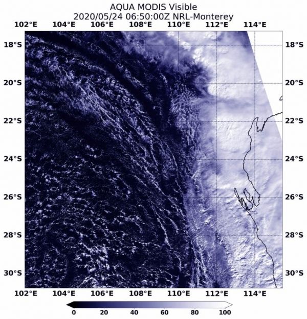
By Sunday, May 24, Tropical Cyclone Mangga had already transitioned to an extra-tropical storm and was affecting the southwestern coast of Australia.
By Sunday, May 24, Tropical Cyclone Mangga had already transitioned to an extra-tropical storm and was affecting the southwestern coast of Australia.
When a storm becomes extra-tropical, it means that a tropical cyclone has lost its “tropical” characteristics. The National Hurricane Center defines “extra-tropical” as a transition that implies both poleward displacement (meaning it moves toward the north or south pole) of the cyclone and the conversion of the cyclone’s primary energy source from the release of latent heat of condensation to baroclinic (the temperature contrast between warm and cold air masses) processes. It is important to note that cyclones can become extra-tropical and retain winds of hurricane or tropical storm force.
The Australian Bureau of Meteorology issued Severe Weather Warnings in Western Australia on Sunday as the extra-tropical system tracked in a southeasterly direction.
The final warning for Mangga came on May 23 at 5 pm EDT (2100 UTC), when it was located near latitude 21.6 south and longitude 104.7 east, about 525 nautical miles west of Learmonth, Australia. Mangga was moving southeast at a speedy 44 knots (51 mph/81 kph) and had maximum sustained winds of 35 knots (40 mph/65 kph).
Read more at NASA / Goddard Space Flight Center
Image: NASA’s Aqua satellite provided a visible look at extra-tropical storm Mangga the southwestern coast of Western Australia on May 24. The center of circulation was difficult to pinpoint in the visible image. Credit: NASA/NRL


