
The second tropical storm of the North Atlantic Ocean hurricane season has formed off the coast of South Carolina.
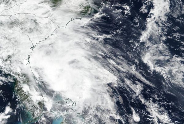
The second tropical storm of the North Atlantic Ocean hurricane season has formed off the coast of South Carolina. NASA-NOAA’s Suomi NPP satellite provided forecasters with a visible image of Tropical Storm Bertha as it was organizing.
On May 27, NOAA’s National Hurricane Center (NHC) issued a Tropical Storm Warning in effect from Edisto Beach, SC to South Santee River, SC.
The Visible Infrared Imaging Radiometer Suite (VIIRS) instrument aboard Suomi NPP provided a visible image of developing Tropical Storm Bertha late on May 26. The imagery showed strong thunderstorms were circling the center of circulation.
Satellite imagery on May 27 at 8:30 a.m. EDT showed the area of disturbed weather that NHC has been tracking over the past day or so quickly became better organized. The circulation had become better defined and the center had reformed beneath the area of deep convection. Those strongest storms were located just off the South Carolina coast.
Read more at NASA/Goddard Space Flight Center
Image: NASA-NOAA's Suomi NPP satellite passed over the western North Atlantic Ocean as Tropical Storm Bertha was organizing off the coast of Georgia and South Carolina on May 26, 2020. Bertha became a tropical storm early on May 27 off the coast of South Carolina. (Credit: NASA Worldview, Earth Observing System Data and Information System (EOSDIS))


