
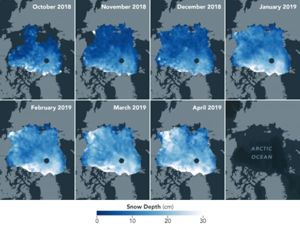
First-of-a-kind maps show how the depth of this insulating snow layer changes from month to month.
For the past two decades, satellites and scientists have revealed an ongoing, decades-long decline in Arctic sea ice, with implications for global ecosystems, weather, and climate. Satellites are now tracking what’s happening to the reflective, insulating layer of snow atop the ice.
The snow layer is an important component of the sea ice system, affecting how the ice grows and melts. In winter, blanket-like snow cover insulates sea ice from frigid polar air, slowing ice growth. In spring, snow cover must melt away before the ice surface can begin to melt. By summer, melt water from the snow collects in ponds atop the ice; this water absorbs heat from the Sun and can accelerate the warming and melting of the ice.
Over the years, scientists have collected ground and airborne surveys of snow depth here and there. But they need routine, widespread measurements to detect the detailed variations in snow depth across the ice cap and how it changes during the year. Those details are now measurable, as scientists have created the first satellite-based maps of snow accumulation on Arctic sea ice.
Continue reading at NASA Earth Observatory
Image via NASA Earth Observatory


