
Tropical Cyclone Nisarga made landfall in west central India on June 4, and the next day NASA’s Terra satellite provided a look at the remnants of the storm.
Tropical Cyclone Nisarga made landfall in west central India on June 4, and the next day NASA’s Terra satellite provided a look at the remnants of the storm.
On June 4 at 11 a.m. EDT (1500 UTC), the Joint Typhoon Warning Center issued their final warning on Tropical cyclone Nisarga. At that time, Nisarga was located near latitude 19.1 degrees north and longitude 73.7 degrees east, about 48 nautical miles east of Mumbai, India. Nisarga was moving to the north-northeast and still maintained maximum sustained winds 65 knots (75 mph/120 kph). As Nisarga tracked inland to the east of Mumbai the storm weakened from hurricane force to a depression, and finally into a remnant low-pressure area.
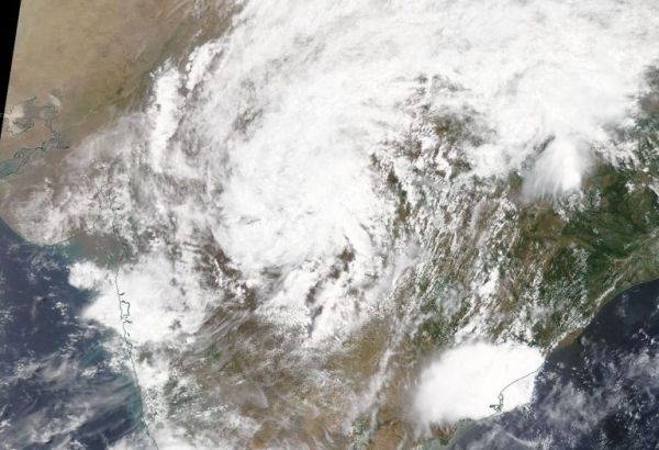
On June 4, the Moderate Resolution Imaging Spectroradiometer or MODIS instrument that flies aboard NASA’s Terra satellite provided a visible image of Nisarga’s remnant clouds, now located over central India.
Read more at NASA / Goddard Space Flight Center
Image: On June 4, 2020, the MODIS instrument that flies aboard NASA’s Terra satellite provided a visible image of the remnants of Tropical Cyclone Nisarga in central India. Credit: NASA Worldview


