
A low-pressure system that developed in the Philippine Sea and tracked over the central Philippines has moved into the South China Sea and become a depression.
A low-pressure system that developed in the Philippine Sea and tracked over the central Philippines has moved into the South China Sea and become a depression. NASA’s Terra satellite provided an image of the newly formed storm.
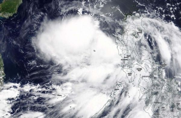
Tropical Depression Nuri (also known as 02W) formed by 5 a.m. EDT (0900 UTC) after passing over Luzon, Philippines and moved into the South China Sea. On June 12, 2020, the Moderate Resolution Imaging Spectroradiometer or MODIS instrument that flies aboard NASA’s Terra satellite provided a visible image of the newly developed Nuri. The image showed a cluster of thunderstorms surrounding the center of circulation and located between the Philippines and Hainan Island, China.
The Joint Typhoon Warning Center noted, “Animated enhanced infrared satellite imagery depicts discrete clusters of deep convection flaring around the periphery of a broad low-level circulation center. A microwave image indicates a broad weakly defined low level center with formative shallow banding [of thunderstorms] wrapping into the center.”
Read more at NASA/Goddard Space Flight Center
Image: On June 12, 2020, the MODIS instrument that flies aboard NASA’s Terra satellite provided a visible image of the newly developed Nuri. The image showed a cluster of thunderstorms surrounding the center of circulation, and located between the Philippines and Hainan Island, China. Credit: NASA/Worldview


