
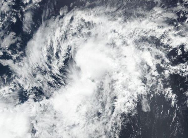
NASA-NOAA’s Suomi NPP satellite provided forecasters with visible image of the Eastern Pacific Ocean’s second tropical storm of the season, Boris.
NASA-NOAA’s Suomi NPP satellite provided forecasters with visible image of the Eastern Pacific Ocean’s second tropical storm of the season, Boris. Boris formed just east of the Central Pacific Ocean’s boundary as it was moving into that region.
The Central Pacific Ocean Basin is the central area of the North Pacific Ocean. Its boundaries are the Marshall Islands to the west and the Line Islands to the east. Hawaii lies in the Central Pacific Ocean.
Satellites have been monitoring the progress and development of Tropical Depression 3 in the Eastern Pacific for two days. On June 25, the depression organized and strengthened into a tropical storm and was renamed Boris at 5 p.m. EDT. Boris reached maximum strength with maximum sustained winds near 40 mph and weakened back to a depression in 12 hours by 5 a.m. EDT (0900 UTC) on June 26.
Visible imagery from NASA satellites help forecasters understand if a storm is organizing or weakening. The Visible Infrared Imaging Radiometer Suite (VIIRS) instrument aboard Suomi NPP provided a visible image of Boris during its short time as a tropical storm on June 26, 2020.
Read more at NASA/Goddard Space Flight Center
Image: On June 25, 2020, NASA-NOAA's Suomi NPP satellite provided forecasters with a visible image of Tropical Storm Boris in the Eastern Pacific Ocean, during its short time as a tropical storm. (Credit: NASA Worldview, Earth Observing System Data and Information System (EOSDIS))


