
Tropical Depression 4E formed late on June 29 and it is forecast to become a remnant low-pressure area by the end of the day on June 30.
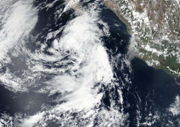
Tropical Depression 4E formed late on June 29 and it is forecast to become a remnant low-pressure area by the end of the day on June 30. NASA-NOAA’s Suomi NPP satellite provided forecasters with an image of the depression, located just southwest of the southern tip of Mexico’s Baja Peninsula.
Tropical Depression Four-E (TD4E) formed on June 29 at 11 p.m. EDT (June 30 at 0300 UTC). It maintained depression status on June 30 and is forecast to weaken.
Visible imagery from NASA satellites help forecasters understand if a storm is organizing or weakening. The Visible Infrared Imaging Radiometer Suite (VIIRS) instrument aboard Suomi NPP provided a visible image of TD4E late on June 29 that showed it remained disorganized and lop-sided. The imagery showed that the bulk of clouds and precipitation was displaced more than 90 nautical miles northeast of the center of circulation. Clouds associated with the depression were streaming over the southern tip of the Baja Peninsula.
Read more at NASA / Goddard Space Flight Center
Image: NASA-NOAA’s Suomi NPP satellite provided forecasters with a visible image of Tropical Depression 4E on June 29, 2020. The depression was located southwest of the southernmost tip of Baja California, Mexico. Credit: NASA Worldview, Earth Observing System Data and Information System (EOSDIS)


