
In Peru, a landslide damaged farmland and stopped the flow of an important local river.
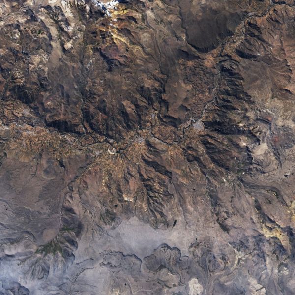
As residents of Peru’s Achoma district slept on June 16, 2020, the earth around them was stirring with activity. At approximately 1:40 a.m., soil and rock on a hillside slipped loose and created a massive landslide. When residents woke up, at least 40 hectares (200 acres) of nearby farmland was destroyed. The landslide also created a natural dam along the Rio Colca and caused flooding in the valley.
The images above show a portion of Colca Valley on June 7 and June 23, 2020, before and after the landslide. The images were acquired by the Operational Land Imager (OLI) on Landsat 8. The earthen dam created by the landslide is reported to be almost 50 meters (160 feet) high.
According to the Geophysical Institute of Peru (IGP), the landslide was the result of unstable terrain and did not have seismic (earthquake) origins. The Geological, Mining, and Metallurgical Institute (INGEMMET) reported that the landslide debris was loose sediments mixed in layers of sand and water-saturated silt and clay. IGP’s National Seismological Center recorded small tremors as the stones and soil settled later.
Continue reading at NASA Earth Observatory
Image via NASA Earth Observatory


