
AIRS measures the infrared and microwave radiation emitted from Earth to study the planet's weather and climate.
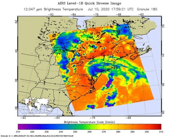
Tropical Storm Fay is sweeping across New England, with the center of the storm making landfall about 10 miles (15 kilometers) north-northeast of Atlantic City, New Jersey, at around 5 p.m. local time. At that time, Fay had maximum sustained winds of around 50 mph (85 kph). Forecasters predicted the storm will dump up to 7 inches (18 centimeters) of rain along its path from Delaware into New Jersey.
NASA's Atmospheric Infrared Sounder (AIRS) collected this image at around 2 p.m. local time on Friday, July 10. The purple regions indicate very cold clouds lofted high into the atmosphere by the storm and generally linked to heavy rainfall. Warmer clouds closer to the ground show up as green and blue, while the orange areas denote mostly cloud-free parts of the sky.
Continue reading at NASA Jet Propulsion Laboratory
Image via NASA Jet Propulsion Laboratory


