
NOAA and partners expect 50-percent boost in ocean data
NOAA’s hurricane gliders are heading to sea this week off the coasts of Puerto Rico, the Gulf of Mexico and the eastern U.S. to collect data that scientists will use to improve the accuracy of hurricane forecast models.
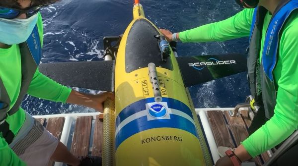
NOAA and partner scientists will deploy unmanned gliders equipped with sensors to measure temperature and salinity down to a half mile below the ocean surface. These sturdy gliders can operate in hurricane conditions and have survived shark attacks as they collect data and transmit it via satellite for use in hurricane forecast models.
For the 2020 hurricane season, NOAA, the U.S. Navy, the U.S. Integrated Ocean Observing System (IOOS®), and academic partners are deploying 30 gliders, which are expected to transmit 50% more data points from the ocean, called ocean observations, compared to previous years. This is possible with more gliders as well as increased collaboration among the partners.
Continue reading at NOAA Research
Image via NOAA Research


