
Forces that shape the Earth’s surface are recorded in a number of natural records, from tree rings to cave formations.
Forces that shape the Earth’s surface are recorded in a number of natural records, from tree rings to cave formations.
In a recent study, researchers from The University of Texas at Austin show that another natural record – sediments packed together at basin margins – offers scientists a powerful tool for understanding the forces that shaped our planet over millions of years, with implications on present day understanding.
The study was published in the journal Geology and uses a computer model to connect distinct patterns in the sedimentary deposits to shifts in climate and tectonic activity.
“We are trying to find a way to distinguish the tectonics and the climate signals,” said lead author Jinyu Zhang, a research associate at UT’s Bureau of Economic Geology. “By using this numerical model we suddenly have this power to simulate the world under different tectonics and climate.”
Read more at University of Texas at Austin
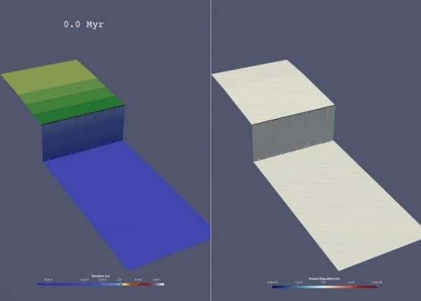
Image: A source-to-sink model run illustrating changes in elevation (left) and erosion/deposition (right). (Credit: Jinyu Zhang/ The University of Texas at Austin)


