
GHGSat’s methane monitoring product has achieved impressive results and is attractive to oil and gas operators.
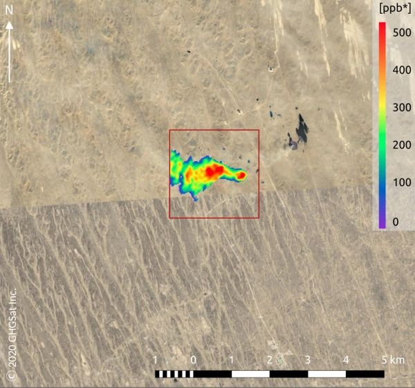
Methane may not be as abundant in the atmosphere as carbon dioxide, but with a global warming potential many times greater than carbon dioxide, monitoring and controlling industrial emissions of this potent gas is imperative to helping combat climate change. GHGSat is a New Space initiative that draws on Copernicus Sentinel-5P data for mapping methane hotspots – and its Claire satellite has now collected more than 60 000 methane measurements of industrial facilities around the world.
Copernicus Sentinel-5P’s role is to map a range of atmospheric gases around the globe every 24 hours. Its Tropomi spectrometer delivers data with a resolution as high as 7 km × 5.5 km for methane, but these data can’t be used to pinpoint specific facilities responsible for emissions. However, GHGSat’s demonstration satellite ‘Claire’ can, but it is helped with a bit of guidance from Sentinel-5P.
Drawing on Sentinel-5P data, the GHGSat tasks Claire to home in on methane point sources. Using this approach, GHGSat has been able to attribute large methane leaks to specific industrial facilities. This is catching the attention of managers responsible for emissions from industries such as oil and gas, waste management, mining, agriculture and power generation.
Continue reading at European Space Agency
Image via European Space Agency


