
A new animation of night-time imagery from NASA-NOAA’s Suomi NPP satellite revealed how the Eastern Pacific Ocean’s Elida transformed into a hurricane over a three-day period.
A new animation of night-time imagery from NASA-NOAA’s Suomi NPP satellite revealed how the Eastern Pacific Ocean’s Elida transformed into a hurricane over a three-day period.
NASA’s Night-Time View of Elida’s Intensification
The Visible Infrared Imaging Radiometer Suite (VIIRS) instrument aboard Suomi NPP provided a night-time image of Hurricane Elida during the early morning hours of Aug. 11 (8 p.m. EDT on Aug. 10). The storm had intensified into a hurricane and an eye was clearly apparent, surrounded by powerful thunderstorms around it.
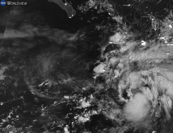
At NASA’s Goddard Space Flight Center in Greenbelt, Md. an animation of night-time imagery from NASA-NOAA’s Suomi NPP satellite shows the development and intensification of Hurricane Elida in the Eastern Pacific Ocean from Aug. 9 to 11, 2020 at 0000 UTC (which is 8 p.m. EDT Aug. 8 to 10). On Aug. 9, Elida appeared somewhat shapeless, and by the night-time hours of Aug.10, the storm took on a general tropical cyclone shape with bands of thunderstorms wrapping into the low-level center. Elida became a hurricane by 5 p.m. EDT (2100 UTC) on Aug. 10. By Aug. 11, Elida had a tight circulation of powerful thunderstorms around the center and an eye was apparent on the night-time imagery. The animation was created using the NASA Worldview application.
Read more at NASA/Goddard Space Flight Center
Image: NASA-NOAA's Suomi NPP satellite passed the Eastern Pacific Ocean overnight on Aug. 10 at 10 p.m. EDT (Aug. 11 at 0000 UTC) and captured a night-time image of Hurricane Elida. (Credit: NASA Worldview, Earth Observing System Data and Information System (EOSDIS))


