
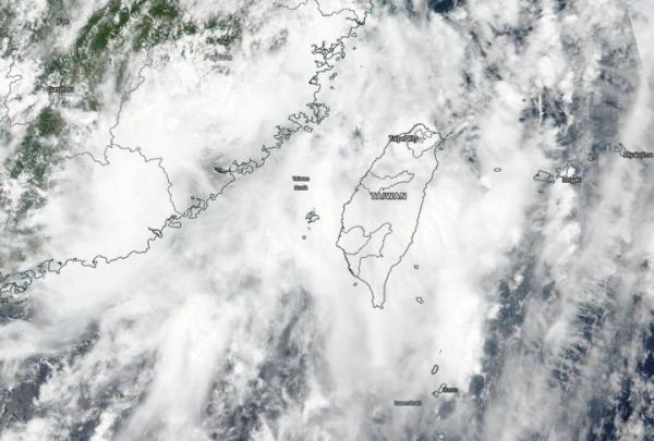
NASA-NOAA’s Suomi NPP satellite provided forecasters with a visible image of former Typhoon Mekkhala shortly after it made landfall in southeastern China.
NASA-NOAA’s Suomi NPP satellite provided forecasters with a visible image of former Typhoon Mekkhala shortly after it made landfall in southeastern China. Wind shear had torn the storm apart.
Mekkhala made landfall in Fujian, southeastern China, bringing strong winds and torrential rain. According to the China Meteorological Agency, the typhoon came ashore in coastal areas of Zhangpu County at around 7:30 a.m. local time on Aug. 11 (7:30 p.m. EDT on Aug. 10). The storm generated at least 170 mm (6.7 inches) of rainfall in Zhangpu County by the middle of the day on Aug. 11.
At 11 p.m. EDT on Aug. 10 (0300 UTC, Aug. 11) the Joint Typhoon Warning Center (JTWC) issued their final bulletin on Mekkhala. At that time, the storm was centered near latitude 24.1 degrees north and longitude 117.7 degrees east, about 216 nautical miles west-southwest of Taipei, Taiwan. Mekkhala’s maximum sustained winds were near 70 knots (81 mph/129 kph) at landfall. It continued to move to the north-northwest.
Read more at NASA/Goddard Space Flight Center
Image: NASA-NOAA's Suomi NPP satellite provided forecasters with a visible image of Tropical Storm Mekkhala as it was making landfall in southeastern China. (Credit: NASA Worldview, Earth Observing System Data and Information System (EOSDIS))


