
The tenth named tropical cyclone of the Atlantic Ocean hurricane season was named today, Aug. 13, after NASA-NOAA’s Suomi NPP satellite provided a nighttime image of the storm.
Tropical Storm Josephine developed from Tropical Depression 11. Over the last two days, Tropical Depression 11 has been moving through the Central Atlantic Ocean and was slow to organize. Satellite imagery indicated the depression became more organized and reached tropical storm strength on Aug. 13.
Josephine is the earliest tenth tropical storm of record in the Atlantic, with the next earliest tenth storm being Tropical Storm Jose on August 22, 2005.
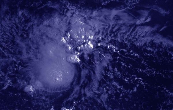
The Visible Infrared Imaging Radiometer Suite (VIIRS) instrument aboard Suomi NPP provided a nighttime image of Josephine on Aug. 13 at 2 a.m. EDT (0500 UTC). The imagery showed that Josephine had strong thunderstorms surrounding its center of circulation and fragmented thunderstorms wrapping into the low-level center from the northern quadrant. The image was created using the NASA Worldview application.
Continue reading at NASA Goddard Space Flight Center
Image via NASA Goddard Space Flight Center


