
NASA’s Terra satellite gathered infrared data on Tropical Depression 14 as it moves through the Caribbean Sea.
Infrared data was used to find the location of the strongest storms. NASA’s Terra satellite uses infrared light to analyze the strength of storms by providing temperature information about the system’s clouds. The strongest thunderstorms that reach high into the atmosphere have the coldest cloud top temperatures.
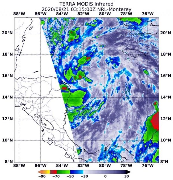
On Aug. 21 at 0315 UTC (Aug. 20 at 11:15 p.m. EDT), the Moderate Resolution Imaging Spectroradiometer or MODIS instrument that flies aboard NASA’s Terra satellite gathered infrared data from the depression that found the coldest cloud top temperatures were as cold as or colder than minus 60 degrees Fahrenheit (minus 51.1 Celsius). The strongest storms were mostly on the western side of the storm. However, a fragmented band of thunderstorms extending to the southeast also contained strong storms.
Continue reading at NASA Goddard Space Flight Center
Image via NASA Goddard Space Flight Center


