
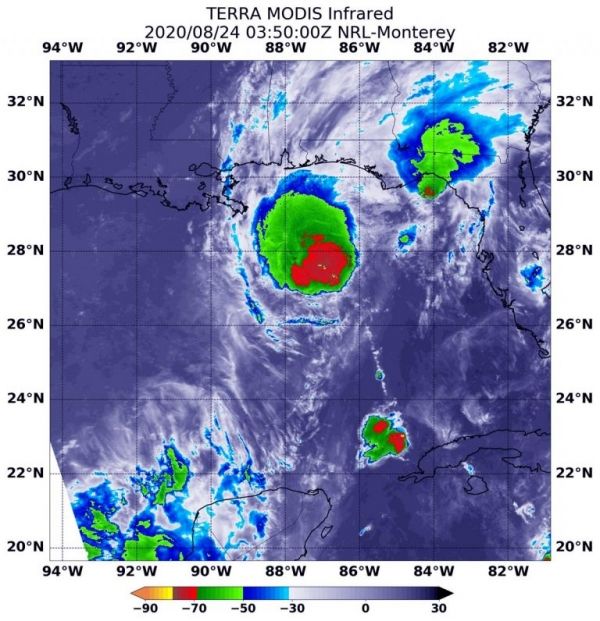
Although a weaker tropical storm on Monday, Aug. 24, Tropical Storm Marco continued to show its soaking capabilities in infrared data from NASA’s Terra satellite.
Marco is feeling the effect of strong southwesterly wind shear. On Aug. 23, the center, as identified by an Air Force Reserve Hurricane Hunter aircraft, was displaced to the southwest edge of the bulk of thunderstorms. That wind shear continues to affect and weaken Marco.
The National Hurricane Center (NHC) posted a Storm Surge Warning from Morgan City, Louisiana to Ocean Springs, Mississippi including Lake Borgne. NHC noted from Morgan City, La. to Ocean Springs, Miss., including Lake Borgne between 2 and 4 feet. NHC noted the deepest water will occur along the immediate coast in areas of onshore winds, where the surge will be accompanied by large and dangerous waves. Surge-related flooding depends on the relative timing of the surge and the tidal cycle, and can vary greatly over short distances.
Continue reading at NASA Goddard Space Flight Center
Image via NASA Goddard Space Flight Center


