
Laura continued to move through the Caribbean Sea on a march toward the Gulf of Mexico.
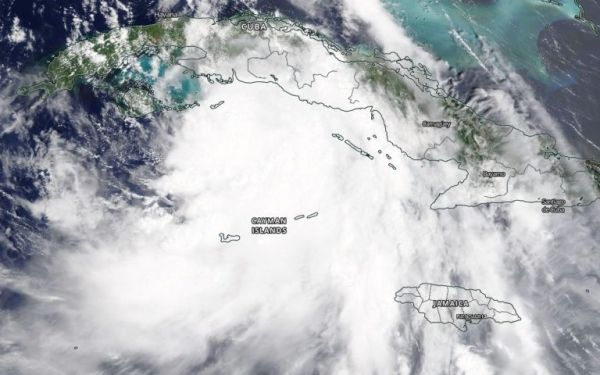
As Tropical Storm Laura continues to move through the Caribbean Sea NASA satellites are providing forecasters with visible, infrared and microwave data.
NOAA’s National Hurricane Center (NHC) issued many warnings and watches on Sunday, Aug. 24. A Tropical Storm Warning is in effect for Little Cayman and Cayman Brac; the Cuban provinces of Camaguey, Las Tunas, Ciego De Avila, Sancti Spiritus, Villa Clara, Cienfuegos, Matanzas, Mayabeque, La Habana, Artemisa, Pinar del Rio, and the Isle of Youth and for the Florida Keys from Craig Key to Key West and the Dry Tortugas.
Continue reading at NASA Goddard Space Flight Center
Image via NASA Goddard Space Flight Center


