
Tropical Storm Laura strengthened to a hurricane in the morning hours of Aug. 25, and NASA provided infrared imagery that showed the structure, temperature and rainmaking capabilities of the storm.
Tropical Storm Laura strengthened to a hurricane in the morning hours of Aug. 25, and NASA provided infrared imagery that showed the structure, temperature and rainmaking capabilities of the storm. When NASA’s Terra satellite and NASA-NOAA’s Suomi NPP satellite passed overhead, both provided different images of Laura as it was about to exit the Caribbean Sea and move into the Gulf of Mexico.
Watches and Warnings on Aug. 25
On Aug. 25, NOAA’s National Hurricane Center (NHC) posted several watches and warnings.
A Storm Surge Warning is in effect from San Luis Pass Texas to the mouth of the Mississippi River, including areas inside the Port Arthur Hurricane Flood Protection system. A Hurricane Warning is in effect from San Luis Pass, Texas to Intracoastal City, Louisiana.
A Tropical Storm Warning is in effect from Sargent, Texas to San Luis Pass and from east of Intracoastal City to the mouth of the Mississippi River. A Storm Surge Watch is in effect from Freeport, Texas to San Luis Pass.
Read more at NASA / Goddard Space Flight Center
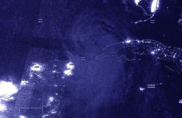
Image: NASA-NOAA’s Suomi NPP satellite passed the Caribbean Sea early on Aug. 25 and captured a nighttime image of Tropical Storm Laura. Not yet named a hurricane, the development of an eye was apparent. Credit: NASA Worldview, Earth Observing System Data and Information System (EOSDIS)


