
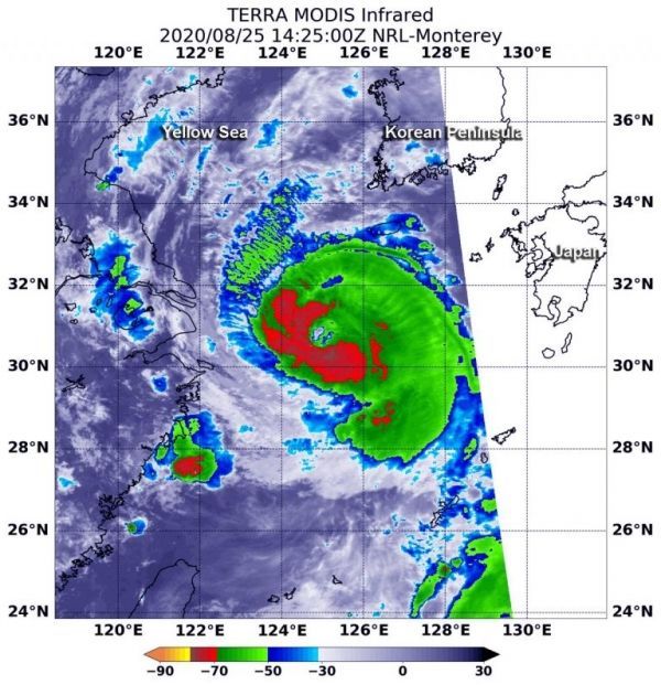
Temperature data revealed that the strongest storms were not totally surrounding the eye.
As Typhoon Bavi continued tracking north through the Yellow Sea, NASA’s Terra satellite used infrared light to identify strongest storms and coldest cloud top temperatures.
On Aug. 25 at 10:25 a.m. EDT (1425 UTC), the Moderate Resolution Imaging Spectroradiometer or MODIS instrument aboard NASA’s Terra satellite gathered temperature information about Bavi’s cloud tops. Infrared data provides temperature information, and the strongest thunderstorms that reach high into the atmosphere have the coldest cloud top temperatures.
Continue reading at NASA Goddard Space Flight Center
Image via NASA Goddard Space Flight Center


