
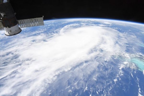
Astronauts aboard the International Space Station provided images of Hurricane Laura as it continues to strengthen in the Gulf of Mexico.
Astronauts aboard the International Space Station provided images of Hurricane Laura as it continues to strengthen in the Gulf of Mexico. Laura is pushing waters from the Gulf of Mexico that could inundate coastal areas miles inland and evacuations are in progress.
Watches and Warnings on Aug. 25
On Aug. 25, NOAA’s National Hurricane Center (NHC) posted several watches and warnings on major Hurricane Laura.
A Storm Surge Warning is in effect for San Luis Pass, Texas to the mouth of the Mississippi River. A Storm Surge Warning means there is a danger of life-threatening inundation, from rising water moving inland from the coastline, during the next 36 hours in the indicated locations. Some of the storm surge forecasts are extreme. From Sea Rim State Park to Intracoastal City, La. including Sabine Lake and Calcasieu Lake, a 10- to 15-foot storm surge is forecast. From Intracoastal City to Morgan City including Vermilion Bay an 8- to 12-foot storm surge is forecast. For additional areas and storm surges, visit: www.nhc.noaa.gov.
Read more at NASA / Goddard Space Flight Center
Image: Astronaut Chris Cassidy aboard the International Space Station captured this photo of Hurricane Laura on Aug. 25, 2020 as it moved through the Gulf of Mexico and continued to strengthen. Credit: NASA/Chris Cassidy


