
Nighttime imagery from NASA-NOAA’s Suomi NPP satellite revealed the Eastern Pacific Ocean’s Tropical Storm Hernan along the coast of western Mexico. By the weekend, Hernan is expected to absorb nearby Tropical Storm Iselle.
Nighttime imagery from NASA-NOAA’s Suomi NPP satellite revealed the Eastern Pacific Ocean’s Tropical Storm Hernan along the coast of western Mexico. By the weekend, Hernan is expected to absorb nearby Tropical Storm Iselle.
Tropical Depression 13E formed by 5 a.m. EDT on Aug. 26 in the Eastern Pacific. Twelve hours later it strengthened to a tropical storm and was renamed Hernan.
NASA’s Night-Time View
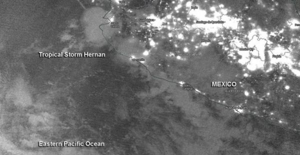
The Visible Infrared Imaging Radiometer Suite (VIIRS) instrument aboard Suomi NPP provided a nighttime image of Hernan on Aug. 26 at 10 p.m. EDT (Aug. 27 at 0000 UTC).
At 5 a.m. EDT on Aug. 27, the National Hurricane Center noted, “Although Hernan is a sheared tropical cyclone, another strong burst of deep convection with cloud tops of minus 83 to minus 86 degrees Celsius has developed near and south through west of the center.” NASA research has shown that cloud tops that cold have the ability to generate heavy rainfall. By 11 a.m. EDT, first light visible satellite imagery reveals that Hernan remains a sheared tropical cyclone with most of the deep convection confined to the western semicircle.
Read more at NASA/Goddard Space Flight Center
Image: NASA-NOAA’s Suomi NPP satellite passed the Eastern Pacific Ocean overnight on Aug. 26 at 10 p.m. EDT (Aug. 27 at 0000 UTC) and captured a nighttime image of Tropical Storm Hernan along the western coast of Mexico. Credit: NASA Worldview, Earth Observing System Data and Information System (EOSDIS)


