
NASA infrared imagery revealed several areas of strong thunderstorms around the center of the recently organized Tropical Storm Maysak.
Tropical Depression 10W formed during the early morning hours on Aug. 28 and quickly organized and strengthened into a tropical storm.
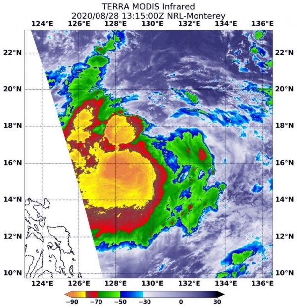
Infrared data provides temperature information, and the strongest thunderstorms that reach highest into the atmosphere have the coldest cloud top temperatures.
On Aug. 28 at 9:15 a.m. EDT (1315 UTC), the Moderate Resolution Imaging Spectroradiometer (MODIS) instrument aboard NASA’s Terra satellite captured an infrared image of cloud top temperatures in Maysak that showed a quick burst of strength. MODIS found the powerful thunderstorms that developed were as cold as or colder than minus 80 degrees Fahrenheit (minus 62.2 degrees Celsius) near Maysak’s center. Surrounding that area were cloud top temperatures were as cold as minus 70 degrees Fahrenheit (minus 56.6. degrees Celsius). All of those areas were generating heavy rain. The storm also appeared somewhat elongated from west to east.
Continue reading at NASA Goddard Space Flight Center
Image via NASA Goddard Space Flight Center


