
The Multi-angle Imaging SpectroRadiometer (MISR) instrument carries nine fixed cameras, each of which views the scene from different angles over a period of about seven minutes.
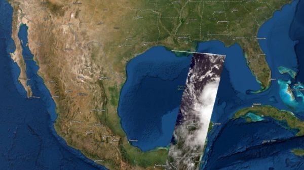
On Aug. 25, several days before Hurricane Laura made landfall as a destructive Category 4 storm in Louisiana, NASA's Terra satellite flew over Laura in the Gulf of Mexico. Using its Multi-angle Imaging SpectroRadiometer (MISR) instrument, the satellite collected data on wind speeds and cloud-top heights as the storm intensified and moved northwest towards the U.S. Gulf Coast.
The NASA Earth Applied Sciences Disasters Program Geographic Information Systems (GIS) team worked closely with representatives from the Esri 3D team to produce the first-ever interactive 3D visualization of MISR cloud-top height data and publish it to the NASA Disasters Mapping Portal. Cloud-top height data can be used to examine the structure of tropical storms and identify features that may indicate future strengthening or weakening of the storm system.
Continue reading at NASA Jet Propulsion Laboratory
Image via NASA Jet Propulsion Laboratory


