
A peninsula that typically sees one typhoon per year might face three landfalling storms in two weeks.
One week after Typhoon Bavi brought fierce winds and rain to North and South Korea, Typhoon Maysak plowed into South Korea as a category 2 storm.
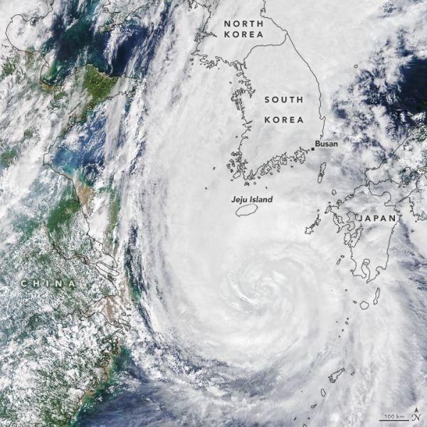
The Moderate Resolution Imaging Spectroradiometer (MODIS) on NASA’s Terra satellite acquired this natural-color image of Maysak in the late morning on September 2, 2020. At the time, the storm had sustained winds of roughly 190 kilometers (120 miles) per hour.
Shortly before landfall, in the early hours of September 3, the U.S. Joint Typhoon Warning Center reported sustained winds of 170 kilometers (105 miles) per hour as the eye of the storm was southwest of Busan, South Korea’s second-largest city and the world’s fifth-largest port. It is believed to be just the sixth typhoon of category 2 strength or higher to hit the Korean Peninsula since 1951.
Continue reading at NASA Earth Observatory
Image via NASA Earth Observatory


