
According to the World Health Organization, there are currently more than 40 million visually impaired people around the world.
According to the World Health Organization, there are currently more than 40 million visually impaired people around the world. This population copes with many daily challenges, some of which are related to traveling within urban spaces. When walking, various environmental features pose danger: stairs, bicycles and cars, physical obstacles on the sidewalk, and more. These severely restrict mobility and independence, affecting the quality of life. There are existing technologies that improve visually impaired pedestrian mobility to some degree by indicating nearby road obstacles. However, those technologies lack significant information about the surrounding space.
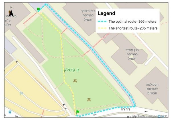
The study, published in the journal Environment and Planning B: Urban Analytics and City Science, examined the possibility of using OpenStreetMap to map spatial data relevant to blind pedestrians while calculating optimized walking routes. OpenStreetMap is an open-source mapping infrastructure based on crowdsourcing of geographic data contributed by citizens all over the world. OpenStreetMap provides maximum flexibility in terms of inserting, editing, and analyzing. It also integrates accumulated mapping data and spatial information.
Continue reading at Technion.
Image via Technion.


