
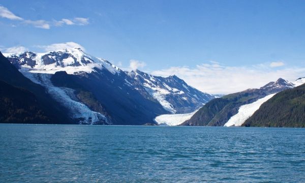
In May of 2020, local geologists identified a steep, unstable slope that has the potential to become a tsunami-generating landslide in Barry Arm, a glacial fjord 60 miles east of Anchorage, Alaska.
With documented cases of tsunami-generating landslides in Alaska including Lituya Bay in 1958 and Taan Fjord in 2015, this new hazard immediately caught the attention of state and federal partners who quickly joined forces to quantify the risk to those living and boating in Alaska’s Prince William Sound, specifically the communities of Whittier, Valdez, Cordova, Tatitlek, and Chenega.
One critical piece of missing information was water depth at the base of the slope. As this seafloor was recently exposed due to the retreat of Barry Glacier, there was no data available for modeling. This data is needed by the U.S. Geological Survey (USGS) and the State of Alaska Division of Geological & Geophysical Surveys (DGGS) to determine the underwater structure of the slope, and by the NOAA/NWS National Tsunami Warning Center (NTWC) to calculate how much water a landslide might displace and where it would go. Two essential questions for determining the risk within Prince William Sound.
Continue reading at NOAA Coast Survey
Image via NOAA Coast Survey


