
NASA’s Aqua satellite analyzed a low-pressure area in the far eastern Atlantic Ocean, and it showed the system becoming more organized.
Soon after Aqua passed overhead, the low became Tropical Depression 21. Hours later, the storm strengthened into Tropical Storm Vicky.
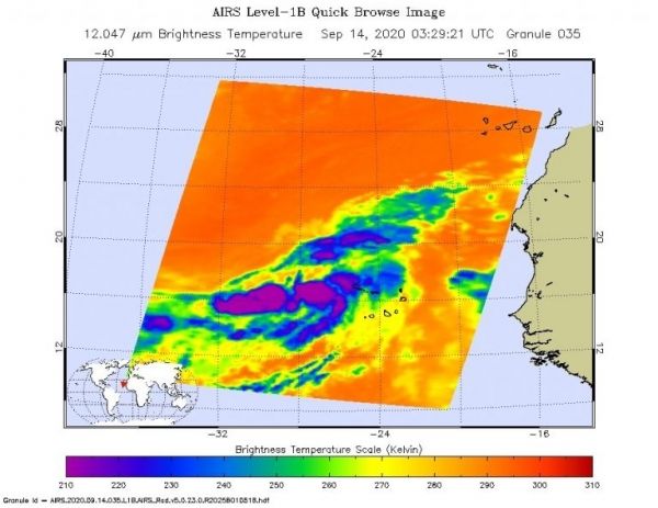
One of the ways NASA researches tropical cyclones is using infrared data that provides temperature information. The AIRS instrument aboard NASA’s Aqua satellite captured a look at those temperatures in the developing low-pressure area and gave insight into the size of the storm and its rainfall potential.
Cloud top temperatures provide information to forecasters about where the strongest storms are located within a tropical cyclone. Tropical cyclones do not always have uniform strength, and some sides are stronger than others. The stronger the storms, the higher they extend into the troposphere, and the colder the cloud temperatures. NASA provides that data to forecasters at NOAA’s National Hurricane Center or NHC so they can incorporate in their forecasting.
Continue reading at NASA Goddard Space Flight Center
Image via NASA Goddard Space Flight Center


